Is the Braemar Gathering connected to any local hill route?
Yes. The Braemar Gathering has a direct connection with a nearby hill: the Creag Choinnich hill race climbs from the village towards the summit and returns by the same general hillside. It is one of the best-known parts of the Gathering’s sporting programme, and it gives visitors a memorable link between a village event and the landscape around it.
That connection can also inspire a walk, but a race route and a walking plan are not quite the same thing. A runner’s line is chosen for speed, and the course may be affected by event arrangements, ground conditions or access advice. Walkers should use a suitable path, allow time for the steep ascent and check conditions before setting out. For a gentler day, Braemar has riverside paths and woodland walks; for a bigger outing, the village is a handy base for hills elsewhere in the Cairngorms.
This guide looks at the Gathering connection, short local routes and the nearby Morrone Birkwood. It also explains how to make the most of a forecast window without turning a pleasant village break into an over-ambitious hill day.
The Gathering and the Creag Choinnich hill race
The Braemar Gathering is a long-established Highland games event, held in the village and attended by competitors, spectators and visitors from far beyond Deeside. Among its traditional contests is the Creag Choinnich hill race. The hill rises immediately above Braemar, so the race is a striking local feature rather than an event that takes competitors away to a distant course.
The race is associated with a steep climb up Creag Choinnich and a return to the village. In that sense, the answer to “is there a local hill route connected to the Gathering?” is a clear yes: the hill race follows the hillside above Braemar, and walkers can visit the same landscape. But do not assume that a public walking route is identical to the race line at every point. Event routes, start arrangements and access can vary, and the fastest line over a slope is not necessarily the safest or most comfortable line for a casual walker.
What walkers should know before following the race line
-
Look for a recognised path or follow the route guidance in the Cairngorms National Park Authority community paths leaflet, rather than cutting directly across rough or steep ground.
-
Give yourself more time than a race result suggests. Walking pace, breaks, muddy conditions and the descent all matter.
-
Check locally for any Gathering-day access arrangements, temporary closures or event activity before setting off.
-
Wear footwear with grip. A short hill can still be slippery, especially after rain or when the ground is churned.
Creag Choinnich is a useful example of a “small hill, serious ascent” outing. Its proximity to the village makes it tempting to squeeze in between other plans, but the climb should still be treated as a hill walk. The view from above Braemar is a fine reward, particularly when the weather is clear, and the quick change from village streets to open hillside is part of its appeal.
Braemar as a low-driving walking base
One of Braemar’s great advantages is that you can arrive, leave the car parked and still have a rewarding choice of walks. The village sits at the meeting of the Dee and Clunie valleys, with local paths, woodland and hills close at hand. That makes it a practical base for a weekend built around the Gathering, or for a longer stay when you want to mix easy walks with more demanding days.
A low-driving plan is especially helpful when the weather is changeable. Rather than committing to a long drive for every outing, you can choose between a short village loop, a riverside walk, Creag Choinnich or a longer hill day according to the forecast. If cloud is low on the tops, a sheltered woodland walk may be the better call. If there is a settled window, you can make an early start for higher ground and keep a shorter option in reserve.
The community paths leaflet from the Cairngorms National Park Authority is a useful planning tool for local paths and connections. Use it to check how walks link together and where paths run; then confirm the day’s conditions and any local access advice. A leaflet is not a substitute for navigation or a current forecast, but it can help you build a sensible outing without unnecessary driving.

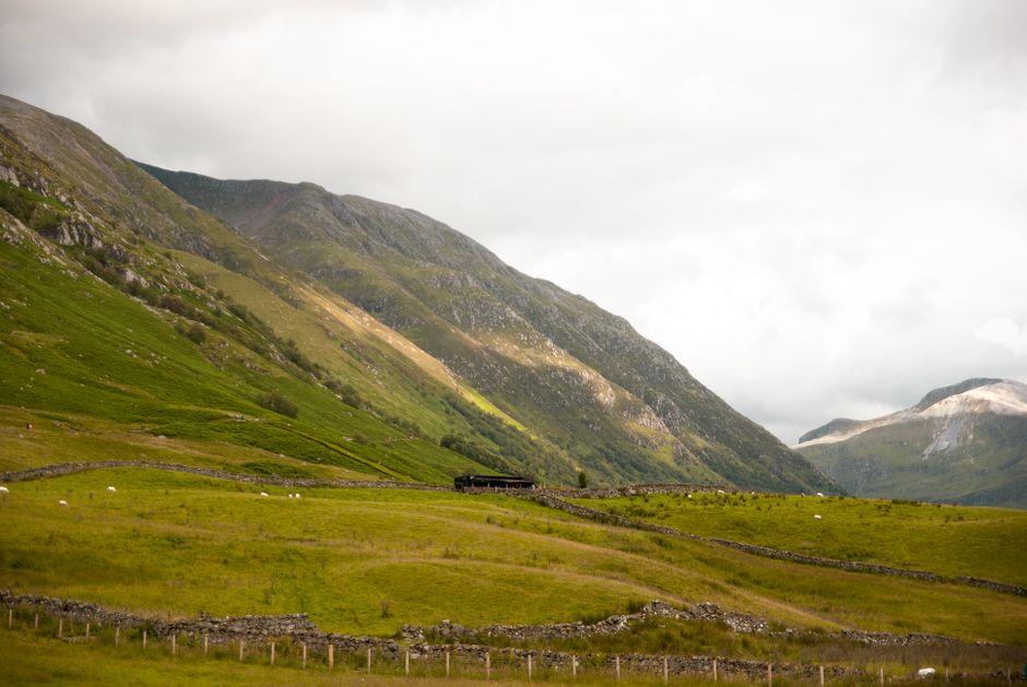
Short village and riverside loops
Not every Braemar walk needs a summit. Short loops by the village and riverside are ideal for an arrival day, a relaxed morning before the Gathering, or a lower-level alternative when the hills are in cloud. They also suit mixed-ability groups and anyone who wants to enjoy the surroundings without committing to a long climb.
A village-and-river wander
Start in the village and follow local paths towards the River Dee or the Clunie, choosing a loop that returns to the centre. The exact circuit depends on which paths you join, so use the community paths leaflet to select a route that fits your time and mobility. Expect a varied walk through the village setting and along water, rather than a remote wilderness outing. Keep dogs under control around livestock and wildlife, and leave gates as you find them.
These lower-level walks can be particularly pleasant in the early morning or evening, when the village is quieter. They are also a good way to get a feel for the landscape before heading higher: notice the direction of the valleys, where cloud is gathering and how exposed the hillsides look. That simple observation can help you decide whether Creag Choinnich is a good choice later in the day.
Choosing a short route
-
For an easy outing, stay close to the village and riverside paths, and turn back whenever conditions or energy levels suggest it.
-
For a longer low-level walk, link paths only where the leaflet shows a clear connection and you are confident about the return.
-
After heavy rain, allow for wet or muddy sections and avoid assuming that a riverside path will be firm underfoot.
Quick climbs with big viewpoints
Creag Choinnich is the obvious short, steep climb from Braemar, and its proximity makes it a natural choice for walkers asking whether the braemar gathering has a hill route attached. It offers a sense of height and a view over the village without requiring a full day out. The climb is still strenuous in places: take your time, carry water and do not judge the effort solely by the distance shown on a map.
For a satisfying outing, set off with enough daylight to walk up and down without rushing. Keep an eye on the cloud base as you climb. A summit that is clear from the village can disappear into mist surprisingly quickly, and a steep path is less straightforward on the descent when visibility is poor. If the forecast suggests strong winds, heavy rain or poor visibility, choose a lower route instead.
Some visitors are interested in whether the route follows race line exactly. The safest answer is that the hill race and a walker’s outing share the same local hillside, but walkers should follow the appropriate path and current route information rather than trying to reproduce a competitor’s precise line. On Gathering day in particular, give the event its space and follow any instructions from organisers or stewards.
Morrone Birkwood: nature and conservation
Above Braemar, the landscape is not only a backdrop for views and exercise. Morrone Birkwood is a valuable local area for nature, with birch woodland and a distinctive transition between wooded ground and the more open hillside. It offers a different kind of outing from a quick summit climb: one where the interest lies in habitat, seasonal change and the small details along the path.
Woodland edges and birch stands can support a range of plants, insects and birds, while the nearby open ground adds further variety. The character of the place changes through the year: fresh growth in spring, leafy shade in summer, autumn colour and a quieter winter landscape. Take time to beinn a' bhùird walk look and listen rather than treating the walk only as a route to a viewpoint.
Areas such as Morrone Birkwood are also a reminder that popular walking landscapes need care. Keep to paths where appropriate, avoid disturbing wildlife and take litter home. If you are walking with a dog, follow signs and keep it close when livestock or wildlife are nearby. Conservation is not an abstract concern here: the condition of paths, woodland and open ground affects the experience for everyone who visits.
Plan around weather and daylight
In Deeside, a good plan begins with the conditions rather than a fixed route. Check the mountain weather forecast before a hill outing, paying attention to wind, precipitation, freezing levels and visibility as well as temperature. Forecasts are guidance, not guarantees; conditions can differ between the village and the higher ground. Recheck if the weather is unsettled, and be ready to change plans.
Conditions
A sensible Braemar choice
Planning note
Clear and settled
Consider Creag Choinnich or a longer hill day if you have the time and experience.
Carry a map and allow for a steady descent, not just the ascent.
Low cloud or poor visibility
Choose a village or riverside loop, or a sheltered woodland walk.
Do not rely on a summit view appearing once you are uphill.
Strong wind or heavy rain
Keep to a short, lower-level outing or postpone the climb.
Exposed slopes can feel much harsher than conditions in the village.
Short winter daylight
Choose a route with a straightforward return and start early.
Carry a headtorch, even if you expect to finish before dark.
For any hill outing, bring suitable layers, water, food, a map and a charged phone. Do not rely on phone coverage or battery life as your only means of navigation. If you are unfamiliar with the terrain, choose a modest objective and tell someone your plan. A short route is not automatically a low-risk route: steep ground, weather and fading light can all change the character of a walk.
Putting together a Gathering weekend
A relaxed itinerary can combine the event with a local walk without making either feel like an afterthought. On the Gathering day, enjoy the games and check whether event activity affects access to the hill. The following morning, if conditions are favourable, take a steady walk on Creag Choinnich. If cloud or wind makes the hill unattractive, choose the riverside or woodland instead. For a longer stay, use Braemar as a base for a separate, properly planned day in the Cairngorms.
-
Before you travel: check the Gathering information, the CNPA community paths leaflet and the latest mountain weather forecast.
-
On arrival: choose a short village loop to get your bearings and assess the weather at valley level.
-
For the hill: allow enough daylight, follow a suitable path and turn back if conditions deteriorate.
-
For a gentler day: explore the riverside or Morrone Birkwood, taking care to respect wildlife, land and other visitors.
So, is there a local hill route connected to the Braemar Gathering?
Yes: Creag Choinnich and its hill race provide a direct link between the Braemar Gathering and the hillside above the village. It is a compelling short climb with a strong local identity, but it should be approached as a walk in its own right, not simply as a race course to copy. Use the community paths leaflet to plan suitable local connections, and check the mountain weather forecast before heading uphill.
Best of all, Braemar does not depend on a single route. You can enjoy short village and riverside loops, explore the nature and conservation interest of Morrone Birkwood, or take on a quick climb for a wide viewpoint. With a little flexibility around weather and daylight, the Gathering becomes a fine starting point for discovering the paths and hills of Deeside.